Friday, July 21, 2006

Tropical Storm Beryl hits Massachusetts

Tropical Storm Beryl quietly made landfall on Nantucket early Friday, bringing a steady, driving rain to coastal Massachusetts. Hours later, it moved out to sea, leaving little but a soaking in its path.

The storm's center hit around 3 a.m., said Jack Beven, hurricane specialist with the National Hurricane Center in Miami.

The wind and rain started to pick up just after midnight, said Rocky Fox, owner of the Chicken Box bar there. But he wasn't scared: "It's the kind that puddles quick," he said. "To us it's just a big old Nor'easter."

Officials said the region fared well. The Coast Guard said they hadn't heard of problems, and no power outages were reported.

"It looks like a gray, rainy day," said Nantucket Fire Department Capt. Steve Murphy as he looked out the window.

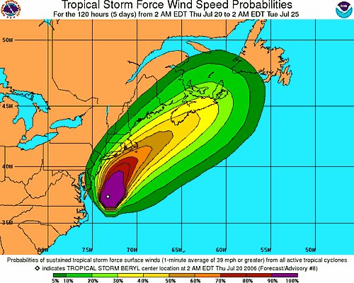
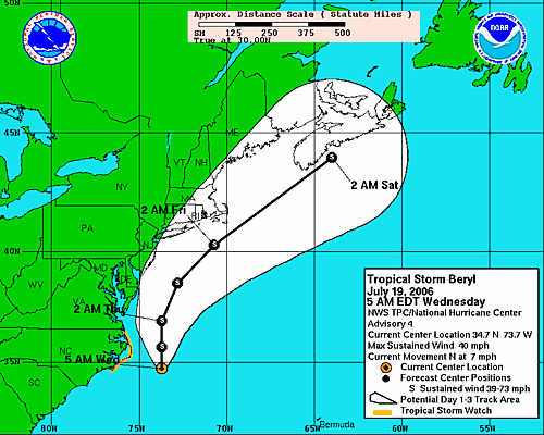
A tropical storm warning issued from the coast of Massachusetts was discontinued Friday morning, according to the National Hurricane Center in Miami. Areas affected included Cape Cod, Nantucket and Martha's Vineyard.

At 5 a.m. EDT, the storm had maximum sustained winds of about 50 mph, and was about 35 miles northeast of Nantucket. It was expected to weaken over the next 24 hours and lose tropical characteristics by Saturday morning.

It was moving at about 21 mph and was expected to increase in speed Friday, forecasters said. The center of Beryl was expected to be near or over Nova Scotia late Friday or early Saturday.

The Coast Guard was monitoring about 50 commercial fishing vessels still on the New England waters near the storm's path late Thursday night, but had no reports of vessels in trouble, said Chief Petty Officer Scott Carr.A tropical storm watch had been issued for eastern Long Island and parts of Connecticut, but was discontinued early Friday as the storm moved northeast.

A tropical storm watch had been issued for eastern Long Island and parts of Connecticut, but was discontinued early Friday as the storm moved northeast.


Workers at Nantucket Moorings on Thursday were making sure their customers' boats were tied down securely, but they weren't panicking.


"That's all we can do for now — make sure lines are secure and people know that the storm is approaching," said Leigh Van Hoven, office manager of the company, which rents and sells moorings.


A record 28 named storms and 15 hurricanes, including destructive Katrina, occurred during last year's June-November Atlantic hurricane season.
The first named storm of the 2006 season, Tropical Storm Alberto, swept over Florida in mid-June, then plowed northward along the coast past the Outer Banks. It was blamed for one drowning.

Thursday, July 20, 2006

Beryl Moving Northward Just off Delmarvia Coastline Thursday

A tropical storm warning has been issued for southeastern Massachusetts from Plymouth, southward and westward to Woods Hole. This includes Cape Cod, Nantucket Island and Martha's Vineyard. Additional watches and warnings may be necessary for parts of Long Island and the New England coastline.

Tropical Storm Beryl is about 295 miles south of Nantucket, Massachusetts, packing winds of 60 mph with gusts to 70 mph. As of 5:00 a.m. EDT Thursday, the center of Beryl was located near 37.8 north and 73.2 west. The storm is moving generally to the north at 9 mph. The surface pressure remains at 1002 millibars, or 29.59 inches. Beryl will continue on a northerly track and will increase in forward speed over the next 24 hours. The shear should increase Thursday morning as an upper-level trough approaches from the west, and will help to prevent any significant intensification Thursday. Also, Beryl will be moving over some cooler waters as it continues to head to the north. It should remain a very strong tropical storm through Thursday afternoon as it moves faster and on more of a northeasterly course. The increased shear will then cause the storm to weaken late Thursday and Thursday night. Our forecast will bring the center of Beryl over or near Nantucket early Friday morning. The system should track to the northeast of southeastern New England by later Friday morning and will start to transition to a non-tropical system as it approaches southern Nova Scotia Friday afternoon. Strong winds should continue to stay offshore until the storm moves close to eastern Long Island and over extreme southeastern New England later Thursday night and early Friday morning. We are expecting 15-30 mph winds with gusts to 40 mph along far eastern Long Island and extreme coastal New England. Places like Block Island and Nantucket Island could have higher wind gusts.

The greatest threat with Beryl will be rough surf and rip currents. All the way from Cape Cod southward to Cape Lookout, there will be an increased threat of rip currents. Swimmers and surfers are urged to use extreme caution or even avoid entering the surf through Friday, as rip currents can drown even the best swimmers.

Wednesday, July 19, 2006

Tropical Storm Beryl Moving North Offshore North Carolina

Tropical Storm Beryl is located 110 miles east-southeast of Cape Hatteras, North Carolina. Beryl continues on a northerly track at 7 mph and maintain tropical storm strength over the next 24 to 48 hours. The storm will track northward, grazing the Outer Banks of North Carolina today. Based on this track, eastern North Carolina and perhaps southeastern Virginia and the Delmarva Peninsula would see some rain squalls with gusty winds tonight, and early Thursday before the storm accelerates northeastward with similar conditions around Cape Cod on Friday.

A tropical storm watch remains in effect for the North Carolina coast from north of Cape Lookout to south of Currituck Beach Light.

Residents of the Outer Banks of North Carolina should be completed with storm preparations at this point, as this area will at least be brushed by Beryl. Those along the coast all the way to Cape Cod should keep a close watch on Beryl's progress, as any deviation west of the forecast track would result in areas around the coast to be directly affected. Outside of the main danger area, Beryl will cause rip currents, rough surf and some beach erosion, as well as possible coastal flooding along the Carolina and mid-Atlantic coasts.

Elsewhere in the Atlantic, there are a few tropical waves to follow. One tropical wave is moving across the Yucatan Peninsula and will eventually move over the Bay of Campeche Wednesday. The close proximity to land should prevent further organization or strengthening

Another tropical wave is along 68 west, south of 25 north. It is causing thunderstorms over the eastern Caribbean.

A third tropical wave in the open Atlantic, near 35 west, south of 16 north. There could be development along this wave over time as well, since the waters are progressively warmer in the path of the wave and there is no significant shear in the region.

Monday, July 17, 2006

Fast Flood Facts from FloodSmart.gov

Did you know?
• Floods and flash floods happen in all 50 states.
• Everyone lives in a flood zone. (For more information, visit the Frequently Asked Questions about Flood Zones)
• Most homeowners insurance does not cover flood damage.
• If you live in a Special Flood Hazard Area (SFHA) or high risk area, your mortgage lender requires you to have flood insurance. (To find out if you are in an SFHA, visit What's Your Flood Risk?)
• Just an inch of water can cause costly damage to your property.
• Flash floods often bring walls of water 10 to 20 feet high.
• A car can easily be carried away by just two feet of floodwater.
• Hurricanes, winter storms and snow melt are common (but often overlooked) causes of flooding.
• New land development can increase flood risk, especially if the construction changes natural runoff paths.
• Federal disaster assistance is usually a loan that must be paid back with interest. For a $50,000 loan at 4% interest, your monthly payment would be around $240 a month ($2,880 a year) for 30 years. Compare that to a $100,000 flood insurance premium, which is about $500 a year ($33 a month).
• If you live in a low to moderate risk area and are eligible for the Preferred Risk Policy, your flood insurance premium may be as low as $112 a year, including coverage for your property's contents.
• You are eligible to purchase flood insurance as long as your community participates in the National Flood Insurance Program. Check the Community Status Book to see if your community is already an NFIP partner.
It takes 30 days after purchase for a policy to take effect, so it's important to buy insurance before the floodwaters start to rise.
• All claims and expenses of the NFIP program are funded by insurance premiums, not tax dollars.