Storms blamed on global warmingGlobal warming, not natural fluctuations in ocean temperature, was the main cause of the ocean heat that energized last year's killer hurricanes, scientists at a federally funded climate laboratory said Thursday.
As a result, continued increases in the Earth's temperature likely will lead to more "enhanced hurricane activity" in future years, said climate analysts Kevin Trenberth and Dennis Shea of the National Center for Atmospheric Research in Boulder, Colo.
Hurricanes draw their energy from the ocean, and scientists on both sides of the debate agree that rising Atlantic Ocean temperatures have driven the past decade's increasingly violent hurricanes.
Last year, for example, the temperature in the tropical Atlantic, where many hurricanes originate, was about 1.6 degrees Fahrenheit above the average for the first 70 years of the 20th century.
The year produced the most named storms on record (28), forcing the National Hurricane Center to go into the Greek alphabet for names. It also brought the most intense Atlantic storm on record (Wilma), the most intense storm to hit the Gulf of Mexico (Rita) and the most destructive storm on record (Katrina).
Some experts, including National Hurricane Center Director Max Mayfield and Colorado State University forecaster William Gray, have discounted the effects of global warming.
They contend that higher ocean temperatures are a result of a long-term cycle known as the Atlantic multidecadal oscillation.
A rise and fall in the ocean's temperature has been documented as far back as the late 1800s.
But in a study described in the Geophysical Research Letters, Trenberth and Shea said the current rise is only partly caused by the oscillation.
They deducted a global temperature increase that scientists have monitored since the 1970s from changes observed in the Atlantic during the same period, and concluded that very little of the increased Atlantic temperature was caused by the ocean temperature cycle.
They attributed 0.8 degrees of the extra temperature to global warming and about 0.2 degrees to the oscillation. The remainder is due to the after-effects of the 2004-05 El Niño warm-water current in the Pacific Ocean and year-to-year variability, they said.
"I don't see how the hell they can say that," said Gray, 76, professor emeritus of atmospheric sciences at Colorado State. "We're just in one of these warming trends due to the ocean circulation and there's nothing we can do about it."
But Georgia Tech scientist Peter Webster, who this year reported that rising ocean temperatures worldwide are directly linked to a 35-year trend of increased hurricane strength, said the calculations by Trenberth and Shea were "fundamentally sound."
"The Atlantic oscillation is there, but it's being out-ridden by global warming," he said.
In a separate report released Thursday, a committee of the National Academy of Sciences said that "proxy" climate records, such as the width of tree rings and the chemical makeup of ice from deep beneath the Greenland snowpack, indicate with "high confidence" that the Earth is warmer now than it has been in the past 400 years.
The academy's study was made at the request of Congress. Industry representatives and global-warming skeptics attacked a earlier proxy temperature study that concluded that the Earth's temperature varied little for 1,000 years, then in the past 25 years began to rise sharply, at an angle reminiscent of a hockey stick.
The study has played a key role in actions by the U.N. Intergovernmental Panel on Climate Change.
The academy panel's study said the proxy evidence provides "less confidence" in climate conditions between 900 and 1600 A.D.
It said "very little confidence" could be placed in average global temperature calculations before 900.
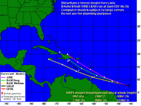
 A tropical wave along 98 west and south of 20 north is flaring up showers and thunderstorms across the Bay of Campeche. This feature is looking better organized, according to the latest satellite loop, with a large, somewhat concentrated, area of deep convection. However, westerly winds aloft are too strong to allow for fast development or falling pressure. The wave is tracking to the west-northwest at 10-15 knots and will bring beneficial showers and thunderstorms to South Texas over the weekend. If this feature persists for a couple of days and becomes a depression, it could cause flooding rains over eastern Mexico.

