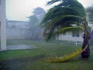
Wednesday, May 09, 2007

Atlantic's 1st named storm forms early

The first named storm of the year formed Wednesday off the southeastern U.S. coast, more than three weeks before the official start of the Atlantic hurricane season, forecasters said.

Subtropical Storm Andrea had top sustained winds around 45 mph Wednesday morning and didn't appear to be much of a threat, the National Hurricane Center in Miami said. Still, a tropical storm watch was issued for parts of Georgia and Florida, meaning tropical storm conditions are possible within 36 hours.


"We're not looking at this system strengthening significantly," said Richard Pasch, a senior hurricane specialist at the center. "We're not viewing this as a major threat."

At 11 a.m. EDT, Andrea was centered about 140 miles southeast of Savannah, Ga., and about 150 miles northeast of Daytona Beach. The storm was moving west at about 3 mph.

Forecasters said no significant rain from the storm was expected to fall over land through at least Thursday morning. But wind-driven waves have been causing beach erosion in South Carolina, Georgia and Florida and the ocean has lapped at beachfront homes and condominiums.

Subtropical systems are hybrid weather formations that are usually weaker than hurricanes and tropical storms. They are kind of a half-breed, sharing characteristics of tropical systems, which get their power from warm ocean water at their centers, and more typical bad weather that forms when warm and cold fronts collide, Pasch said.

Forecasters said Andrea has the warm center characteristic of tropical storms but its core is not particularly well defined. In addition, its winds are farther out from the center than they would be in a tropical storm.

Typically about one subtropical storm forms each year, but they often turn into tropical storms. That doesn't appear to be the case with Andrea, senior hurricane specialist Jack Beven said. It only has a small area of warmer water to draw energy from and is also facing dry winds.

He said it wasn't unusual for the storm to form in May, outside the hurricane season that starts June 1 and end Nov. 30.

"What we call the hurricane season is a totally manmade creation. Nature doesn't always pay attention to that," Beven said.

Eighteen tropical storms and four hurricanes have been recorded in that month since 1851, and none of the hurricanes made landfall in the U.S. The earliest hurricane to strike the U.S. was Alma in northwest Florida on June 9, 1966.

Private and university forecasters have predicted that the 2007 season will be especially active, producing up to 17 tropical storms and hurricanes and a "well above average" possibility of at least one striking the U.S. The federal government plans to release its predictions May 22.
The Atlantic basin has been in a busy period for hurricanes since 1995. Some federal forecasters believe this is part of a natural cycle. But the Intergovernmental Panel on Climate Change, a U.N.-sponsored group, says global warming caused by humans has led to an increase in stronger hurricanes.

Tuesday, May 08, 2007

Florida in the Bull’s Eye this Hurricane Season

"We’re in for a Rough Year," Says AccuWeather.com’s Bastardi

(State College, PA - May 8, 2007) - AccuWeather.com Chief Hurricane Forecaster Joe Bastardi and his team expect this season’s hurricanes and tropical storms to pose a far greater threat to lives and property than last year’s, with significantly more storms striking the US.

In the AccuWeather.com 2007 Hurricane Season Forecast released today, Bastardi warns that six or seven storms will strike the US coast. This includes the possibility of multiple strikes by the same storm, such as the way Hurricanes Andrew and Katrina – both extreme examples – struck Florida before later striking the US Gulf Coast. The majority of these landfalls are projected for the Gulf Coast from the mouth of the Mississippi River to Cape Hatteras, NC, with the center of the bull’s eye on Florida.

AccuWeather.com forecasts 13 or 14 total storms in the Atlantic Basin, with three or more likely to be major hurricanes of Category 3 or greater.

Bastardi, who in March of last year correctly forecast that the Gulf Coast would get "minimal" attention by that season’s hurricanes, said that this year’s indicators all point to the Gulf being at much higher risk for destructive tropical weather than last year. Said Bastardi, "The highest area of risk has swung southwest from the Atlantic to Florida and the eastern and central Gulf Coast regions. In past years that exhibited the same climatological patterns we expect this season, these areas were the main target of Atlantic hurricanes and tropical storms". Said Bastardi, "The highest area of risk has swung southwest from the Atlantic to Florida and the eastern and central Gulf Coast regions. In past years that exhibited the same climatological patterns we expect this season, these areas were the main target of Atlantic hurricanes and tropical storms".

"Some of those years also saw a storm break out of the pack and head up the East Coast, and we would not be surprised to see this scenario play out this year as well. Any storm that strikes north of Hatteras has increased potential to be a major one," he said.

Bastardi described the climatological patterns that he and his team expect to have an impact on this year’s hurricane season, including:

The occurrence of a weak La Niña – a formation of cooler–than–normal Pacific waters – in the wake of an El Niño at the end of last year
The current warm–water cycle that is occurring in the area of the Atlantic that is a breeding ground for hurricanes, as well as forecast precipitation and air pressure patterns expected during hurricane season
How spring is evolving across the North American continent
How summer is projected to evolve across the US
Forecasted air pressure oscillations over the Pacific, and diminished dry air over the tropical AtlanticMany of the climatological patterns currently occurring or projected for this hurricane season are similar to those of the 1930s through the 1950s, which was a period marked by frenzied hurricane activity. Cautioned AccuWeather.com Director of Forecast Operations Ken Reeves, "It is true that one of the patterns we are accounting for is the formation of a La Niña following the recent El Niño, but too often, the impact of a La Niña – or an El Niño – on a hurricane season is oversimplified. It is just one of many patterns that needs to be examined when predicting a hurricane season, and often not the most important one." Regarding the impact that the 2007 hurricane season is projected to have, Reeves said, "The heightened threat we foresee for Florida and the eastern Gulf Coast could have significant implications for the areas still recovering from the devastation wrought by the hurricanes of 2004 and 2005."

Added Reeves, "Those living farther up the East Coast should by no means let down their guard. While the threat there is lower than last year, ‘less risk’ does not mean ‘no risk.’ We expect at least one storm will threaten these areas."

Regarding the impact that this season will have on energy prices, Reeves said, "Any time you have hurricanes roaming the Gulf of Mexico, there is the possibility that energy production could be disrupted. This obviously could affect the prices consumers pay for gasoline and natural gas."

Concluded Reeves, "Overall, we will see more powerful storms across the board than we did last year. We will not get anywhere near the amount of storms that we did in 2005, but it is the intensity of the storms we do get that will be of major concern. It goes without saying that if I were living along the Gulf Coast, Florida, or the Carolinas, I would do all I could to make sure that my family and I were prepared for the possibility of a landfalling tropical storm or hurricane. This is always prudent, but it is especially so during times such as this season, when we are likely to see above-normal storm activity."

Regarding the possibility of a tropical storm or hurricane striking the Northeast, Bastardi’s 2006 forecast still holds: the region is likely be the target of a couple of storm strikes over the next ten years. "Last year the Northeast may have dodged a bullet, but unfortunately you can only be lucky for so long. As we are in a pattern similar to that of the late 1930s through the 1950s, it is important to note that during that span the Northeast was hit by major storms." Last year, Bastardi forecast that the East Coast would be far more likely than the eastern and central Gulf to see hurricane activity, and indeed, most of 2006’s ten storms tracked farther east than in 2005 – including Ernesto, which caused a half–billion dollars in damages in the region from North Carolina to New Jersey.

In summarizing what can be expected this summer, Bastardi said, "We are living in a time of climatic hardship. We’re in a cycle where weather extremes are more the norm and not the exception. One of the ways this manifests itself is in the intensity and frequency of hurricanes and tropical storms. Last year was just a breather, because the overall pattern of increased landfalls shows no sign of reversing in the near term."

Hurricane season begins June 1 and ends November 30.

Monday, May 07, 2007

An Early Start to the Season?


A strong low pressure system has formed off the East Coast of the United States. This system has developed central thunderstorm activity while remaining over the warmish waters of the Gulf Stream. Sea surface temperatures underneath the area of activity are below the usual threshold of 26C, however, upper level temperatures are cold enough that the storm could develop some tropical characteristics.

The forecast track moves it southwestward over the next few days. I'm showing the UKMET model here because it has been the most consistent and best forecast for this storm. This looks like classical subtropical development.

Friday, April 20, 2007

Global warming may spawn wind shear able to hobble hurricanes, study finds

In the doomsday catastrophe of global warming - when Mar-a-Lago is submerged, Lake Okeechobee is an ocean bay and the Wellington polo fields are oceanfront property - rises a glimmer of good news.

Hurricanes spawned in the Atlantic Ocean may not be as monstrous or intense as some scientists have predicted.

Could global warming be a good thing for South Florida or whatever's left of it?

A pair of climatologists, one at the University of Miami and one in Princeton, N.J., think so.

"The environmental changes found here do not suggest a strong increase in tropical Atlantic hurricane activity during the 21st century," said coauthor Brian Soden, associate professor of meteorology and physical oceanography at the Rosenstiel School at the University of Miami.

Ever-warming seas - the very reason for more and bigger hurricanes - may foster milder winds in the Pacific Ocean, resulting in more wind shear in the Atlantic basin, stunting the growth of storms and slicing through those that do form.

"That's good for whatever part of Florida will still be above sea level," said Assistant Palm Beach County Administrator Vince Bonvento, who heads emergency management efforts.

Soden and lead author Gabriel Vecchi studied 100-year projections made by 18 global computer models to reach their findings, which will be published today in the American Geophysical Union's Geophysical Research Letters.

This is the first study to say that wind shear may counteract the increase in numbers and strength of hurricanes caused by global warming. "In fact, the wind shear changes are driven by global warming," Soden said.

"The collection of models consistently showed an increase in wind shear over the Atlantic and the eastern Pacific," he said.

On the other hand, the western Pacific and the Indian Ocean would receive the effect of warmer ocean water and less wind shear: the super storms.

The study concentrated on wind shear over the tropical Atlantic and its correlation with the Pacific Walker circulation, the immense loop of winds that affects climate across the globe. The slower the Walker circulation, the stronger the wind shear.

North of the equator, hurricanes are sheared when high-altitude westerly winds slice the tops of hurricanes pushed by low-altitude easterly winds.

Other scientists say that although Soden and Vecchi's conclusions based on the computer models are good, the models themselves aren't so good.

"Not a single model gets El NiÒo correct," said retired state climatologist Jim O'Brien, professor emeritus at Florida State University. "One has a permanent El NiÒo, and another has El NiÒo every other year."

El NiÒo, warmer-than-average Pacific equatorial water off the South American coast, helps slow the Walker circulation.

Nevertheless, O'Brien is one of the scientists who doesn't believe global warming is responsible for the current cycle of intense storms in the Atlantic. "The total number of storms worldwide is about the same, it just depends on the ocean," he said.

Kevin Trenberth of the National Center for Atmospheric Research in Boulder, Colo., doesn't trust the models either. "They don't have hurricanes, and they don't do El NiÒo correctly," he said. "With so little confidence, why should we believe this result?"

Even if the study's conclusions are correct on average, that doesn't mean there won't be years like 2005 with 28 named storms and seven major hurricanes.

"This certainly isn't the last word on global warming," Soden said. "There's a lot of debate about how clearly they're (connected). There will be a lot more research on this."

He also said it's not yet possible to tell how much the increased wind shear will offset the strength of storms strengthened by higher ocean temperatures.

"For those who are just being born, it's good news," said Palm Beach County's Bonvento. "For us middle-aged and older, be prepared."

Thursday, April 19, 2007

N.C. State Team Predict 8-9 Hurricanes

The hurricane research team at North Carolina State University accurately predicted a mild 2006 storm season last year. More established forecasters predicted things would be much worse.

Now, this year the North Carolina State team is saying that the 2007 season will be much more active.

Researchers at North Carolina State University are in their third year of hurricane forecasting.

They said the Atlantic basin will brew 12 to 13 named storms and eight to nine hurricanes, including four or five major hurricanes.

Forecasters said there is a 75 percent chance a hurricane will make landfall along the eastern seaboard and an equally strong chance that a hurricane will hit the Gulf of Mexico coastline.

William Gray, who has become the nation's most reliable hurricane forecaster over the past 24 years, had estimated last season would produce 17 named storms and nine hurricanes, but later revised his projections downward.

The National Hurricane Center also predicted an active hurricane season, saying 13 to 16 named storms would form.

Thursday, April 05, 2007

La Nina may form, but timing and strength uncertain

A La Nina weather anomaly may be forming in the equatorial Pacific, but a fog of unpredictability enshrouds when it may strike and how strong it might be, according to the Climate Prediction Center of the U.S. National Oceanic Atmospheric Administration.

In its monthly update issued Thursday, the center said "atmospheric and oceanic conditions are consistent with a trend towards a Pacific cold (La Nina) episode."

The formation of La Nina could lead to more storms in the 2007 Atlantic hurricane season, which runs from June 1 to November 30, forecasters say.

The weather anomaly could occur between May and July of this year.

However, the latest computer models "indicate considerable uncertainty as to when La Nina might develop and how strong it might be," according to the CPC.

La Nina is less famous than El Nino, during which waters in the Pacific turn abnormally warm.

That warming could wreak havoc in the weather across the Asia-Pacific region, causing flooding in Peru and Ecuador in South America and withering drought in Australia, Indonesia and the Philippines.

El Nino also spurs stronger wind shear in the Atlantic basin. This greatly hindered storm formation in 2006 when only 10 occurred, sharply lower than the record 28 storms of the year before which included monsters like hurricanes Katrina, Rita and Wilma.

La Nina has the opposite effect, and U.S. government and private forecasters said it may cause a higher-than-normal number of hurricanes. Most predictions pegged the number of storms this year at 17.

El Nino means literally "little boy" in Spanish. The name was used by Latin American anchovy fishermen in the 19th century who first noticed the anomaly because it usually peaked during Christmas.

The last La Nina occurred from 1998 to 2001, leading to drought across much of the western United States.

The CPC forecast is available on: http://www.cpc.ncep.noaa.gov/products/analysis_monitoring/enso_a dvisory/ensodisc.html

Colorado State University scientists foresee a "very active" storm season

With El Nino no longer running interference, more hurricanes and tropical storms are expected this summer, forecasters say.

Scientists at Colorado State University say the dissipation of the El Nino weather pattern in the Pacific in recent months is likely to bring more hurricanes sweeping up the Atlantic coast, beginning in June.

Whether the culprit is global climate change or just the result of cyclical patterns, this year's hurricane season is likely to be bad, the forecasters say.

"We are predicting a very active season this year," said Philip Klotzbach, a research associate in the atmospheric science department at Colorado State.

The season that begins June 1 and ends Nov. 30. For a storm to merit an official name, it must have sustained winds of 39 mph. It's a hurricane at 74 mph.

The Colorado State report is the first of three traditional hurricane forecasts. AccuWeather.com is due to issue a forecast in May, followed by the National Weather Service's National Hurricane Center on May 22.

Klotzbach and forecaster William Gray are predicting 17 named storms, including nine hurricanes, five of which will be Category 3 storms with winds of at least 111 mph.

The number of storms predicted is almost twice the long-term average. For the record, that's 9.6 named storms, 5.9 of which are hurricanes, including 2.3 major hurricanes.

Still, the report said, the East Coast isn't likely to be hit as hard as it was in 2004 or 2005, when a series of hurricanes - including Katrina - battered Florida and the Gulf Coast.

Forecasters concede that this is an inexact science. In April 2006, the Colorado group predicted nine hurricanes for 2006, but the season brought only five - none of which made landfall in the U.S.

In 2007, forecasters say, there's a 74 percent chance that at least one Category 3 will strike the U.S.

Items to have on hand in the event of severe tropical storms

1. Car tank filled with gasoline.
2. Extra ice in freezer.
3. Special infant needs - diapers, bottles and formula, medicine.
4. Camera and film; extra batteries.
5. Sterno fuel and unit; charcoal.
6. Extra drinking water.
7. Tub filled with water.
8. Pets inside or otherwise protected.
9. Loose outside objects stored or secured.
10. First-aid kit and manuals.
11. Tree branches tied or cut.
12. TV antenna taken down.
13. Fire extinguisher.
14. Flashlight or lantern, extra batteries.
15. Radio, extra batteries.
16. Raingear, change of clothing; heavy/sturdy boots or shoes; work gloves.
17. Extra cash/credit cards.
18. Personal hygiene items.
19. Medications and specific medical information.
20. Pantry well stocked: canned goods, dry milk, dry cereals and baby food, powered drinks, bread; non-electric can opener; plastic utensils; garbage bags.

Tuesday, April 03, 2007

Forecasters see very active 2007 hurricane season

DENVER - The 2007 Atlantic hurricane season should be "very active," with nine hurricanes and a good chance that at least one major hurricane will hit the U.S. coast, a top researcher said today.

Forecaster William Gray said he expects 17 named storms in all this year, five of them major hurricanes with sustained winds of 111 mph or greater. The probability of a major hurricane making landfall on the U.S. coast this year: 74 percent, compared with the average of 52 percent over the past century, he said.

Last year, Gray's forecast and government forecasts were higher than what the Atlantic hurricane season produced.

There were nine named Atlantic storms in 2006 and five hurricanes, two of them major, in what was considered a "near normal" season. None of those hurricanes hit the U.S. Atlantic coast - only the 11th time that has occurred since 1945.

Gray's research team at Colorado State University said an unexpected late El Nino contributed to the calmer season last year. El Niño - a warming in the Pacific Ocean - has far-reaching effects that include changing wind patterns in the eastern Atlantic, which can disrupt the formation of hurricanes there.

A weak to moderate El Niño occurred in December and January but dissipated rapidly, said Phil Klotzbach, a member of Gray's team.

"We do not think that's going to be an inhibiting factor this year," Klotzbach said.

The team's forecasts are based on global oceanic and atmospheric conditions.

The Atlantic hurricane season, which runs from June 1 to Nov. 30, averages 9.6 named storms, 5.9 hurricanes and 2.3 intense hurricanes per year.

The devastating 2005 season set a record with 28 named storms, 15 of them hurricanes. Four of those hurricanes hit the U.S. coast, the worst among them Katrina, which devastated New Orleans and leveled parts of the Gulf Coast region.

Gray has spent more than 40 years in tropical weather research. He heads the Tropical Meteorology Project at Colorado State.

Thursday, March 01, 2007

Study promises better forecasts of storm strengths

In September 2005, as Hurricane Rita raged to near-record fury in the Gulf of Mexico, scientists aboard a Navy plane achieved something remarkable: a close-up view of a mysterious process that allows killer storms to gain strength rapidly.

Their observations could lead to vastly more precise hurricane forecasts in several years. And so could the unusually detailed computer model that made the research possible, say the scientists, whose findings become public Friday in the journal Science.

"I'm an absolutely, unabashed admirer of this work," said Hugh Willoughby, a Florida International University hurricane researcher who wrote a commentary about the research for the same edition of the journal.

"It shows that hurricane modeling has matured to an extent that's really surprising." Willoughby said the study shows that hurricane models can be precise enough to aid costly decisions about when to close schools, evacuate barrier islands and shut down oil rigs - if the government will make the necessary computing power available.

"When a hurricane is coming, people always overreact - except when it really matters, and then they underreact," added Willoughby, a former director of the federal Hurricane Research Division in Miami. With better forecasts, "you can make good decisions, and you don't have to agonize over them."

The researchers running the study - based at the University of Washington, the University of Miami and the National Center for Atmospheric Research in Colorado - used the model and other high-tech imagery to direct the path of the plane as it circled Rita's eye.
That let them observe the storm at the precise time when it was shedding and replacing the band of intense winds and rain around the eye.

This change - known as the "eyewall replacement cycle" - occurs only in major hurricanes. It often signals sudden, terrifying surges in intensity, such as the one Hurricane Charley underwent in the hours before it tore into Southwest Florida as a Category 4 storm in August 2004.

Better understanding of the cycle could allow meteorologists to predict when these changes will occur, said Robert Houze, the University of Washington researcher who led the team. Never before have scientists gotten such a close view of the process, he added.

"It's very exciting that the model was able to predict and simulate the way that Rita evolved and developed an eyewall replacement," Houze said. "We could only do this with a high-resolution model."

The model used in the study, known by the cryptic name MM5, is hardly new - it has been around in various versions for decades. But the University of Miami researchers ran it at unusually high resolution, so that it could pinpoint features of the atmosphere about a mile across.

That's far more precise than what federal forecasters typically use for the models that guide the National Hurricane Center's forecasts.

"With a very coarse net, you can only catch big fish," said paper co-author Shuyi Chen, an associate professor of meteorology and physical oceanography at the University of Miami. "You have to have a very fine mesh in your computer model to actually see the eye and the eyewall."
The downside: It takes more computing power to run the models at higher resolution. On top of that, the government's hurricane models must run every six hours during a storm, and must compete with numerous other weather and climate models that the National Oceanic and Atmospheric Administration operates.

NOAA is debuting a new state-of-the-art hurricane model this coming season, but it will start out with a grid about five times wider than the one the Miami researchers used, said Frank Marks, director of the federal Hurricane Research Division in Miami. NOAA is aiming for higher resolutions, "but I don't think we're there yet," he said.

During the time the researchers were studying it, Rita became the fourth most intense Atlantic hurricane on record, with sustained wind speeds peaking at 178 mph. (Hurricane Katrina, which killed more than 1,300 people in Louisiana and Mississippi a month earlier, ranks No. 6 in intensity.)

Rita weakened to a 115 mph, Category 3 storm by the time it made landfall near the Texas-Louisiana border. It directly killed seven people in the United States while causing one of the largest evacuations in the nation's history, sending an estimated 2 million people fleeing from the Texas Gulf Coast.

Dozens more died during the evacuation, including 23 nursing home patients whose bus exploded near Dallas.

Houze said the scientists planned the expeditions three years in advance, not knowing that August and September 2005 would produce some of the fiercest hurricanes ever recorded.
"We were lucky," he said.

Wednesday, February 28, 2007

La Nina's brewing, forecasters warn of more hurricanes

Forecasters warned Tuesday that a La Nina weather pattern — the nasty flip side of El Nino — is brewing, bringing with it the threat of more hurricanes for the Atlantic.

Officials at the National Oceanic and Atmospheric Administration announced the official end of a brief and mild El Nino that started last year. That El Nino was credited with partially shutting down last summer's Atlantic hurricane activity in the midst of what was supposed to be a busy season.

"We're seeing a shift to the La Nina, it's clearly in the data," NOAA Administrator Conrad Lautenbacher said. La Nina, a cooling of the mid-Pacific equatorial region, has not officially begun because it's a process with several months with specific temperature thresholds, but the trend is obvious based on satellite and ocean measurement data, he said.

"It certainly won't be welcome news for those living off the coast right now," Lautenbacher said. But he said that doesn't mean Atlantic seaboard residents should sell their homes.

Forecasters don't know how strong this La Nina will be. However, it typically means more hurricanes in the Atlantic, fewer in the Pacific, less rain and more heat for the already drought-stricken South, and a milder spring and summer in the north, Lautenbacher said. The central plains of the United States tend be drier in the fall during La Ninas, while the Pacific Northwest tends to be wetter in the late fall and early winter.

Of special concern is west Texas which is already in a long-term drought, which during a La Nina will likely get worse, Lautenbacher said.

Historically, El Ninos and La Ninas are difficult to forecast, said National Center for Atmospheric Research senior scientist Michael Glantz, who studies how they effect humans.

"I don't see it as a useful forecast," Glantz said. "Every event since they've been looking at El Nino ... surprised scientists."

La Ninas tend to develop from March to June and reach peak intensity at the end of the year and into the next February, according to Vernon Kousky, NOAA's top El Nino/La Nina expert. La Nina winters tend to be warmer than normal in the Southeast and colder than normal in the Northwest.

Andrew Weaver, a meteorology professor at the University of Victoria in Canada, said NOAA's forecast looks good because the signs of a brewing La Nina are apparent just below the ocean's surface.

"La Nina is the evil twin sister of El Nino, so it's good or bad depending on where you live," Weaver said. However, in general La Ninas do not have as costly effects on humans as El Ninos do, he said.

The last lengthy La Nina, from 1998 to 2001, helped cause a serious drought in much of the West, according to NOAA drought specialist Douglas Lecomte.

"There are winners and losers, people tend to concentrate on the losers," Lautenbacher said.

Thursday, February 01, 2007

Hurricane Names for 2007

For every year, there is a pre-approved list of names for tropical storms and hurricanes. These lists have been generated by the National Hurricane Center since 1953. At first, the lists consisted of only female names; however, since 1979, the lists alternate between male and female.

Hurricanes are named alphabetically from the list in chronological order. Thus the first tropical storm or hurricane of the year has a name that begins with "A" and the second is given the name that begins with "B." The lists contain names that begin from A to W, but exclude names that begin with a "Q" or "U."

There are six lists that continue to rotate. The lists only change when there is a hurricane that is so devastating, the name is retired and another name replaces it.

2007 Hurricane Names
Andrea
Barry
Chantal
Dean
Erin
Felix
Gabrielle
Humberto
Ingrid
Jerry
Karen
Lorenzo
Melissa
Noel
Olga
Pablo
Rebekah
Sebastien
Tanya
Van
Wendy

Warming linked to stronger hurricanes

Global warming has made stronger hurricanes, including those in the Atlantic such as Katrina, an authoritative panel on climate change has concluded for the first time, participants in the deliberations said Thursday.

During marathon meetings in Paris, the Intergovernmental Panel on Climate Change approved language that said an increase in hurricane and tropical cyclone strength since 1970 "more likely than not" can be attributed to man-made global warming, according to Leonard Fields of Barbados and Cedric Nelom of Surinam.

In its last report in 2001, the same panel had said there was not enough evidence to make such a conclusion.

"It is very important" that the language is so strong this time, said Fields, whose country is on the path of many hurricanes. "Insurance companies watch the language, too."
The panel did note that the increase in stronger storms differs in various parts of the globe, but that the storms that strike the Americas are global warming-influenced, according to another participant.

Fields said that the report notes that most of the changes have been seen in the North Atlantic.
The report - scheduled to be released Friday morning - is also a marked departure from a November 2006 statement by the World Meteorological Organization, which helped found the IPPC.

The meteorological organization, after contentious debate, said it could not link past stronger storms to global warming. The debate about whether stronger hurricanes can be linked to global warming has been dividing a scientific community that is otherwise largely united in agreeing that global warming is human-made and a problem.

Massachusetts Institute of Technology professor Kerry Emanuel, who pioneered much of the research linking global warming to an uptick in hurricane strength, looked at the original language in an IPCC draft and called it "a pretty strong statement."

"I think we've seen a pretty clear signal in the Atlantic," Emanuel said. The increase in Atlantic hurricane strength "is so beautifully correlated with sea surface there can't be much doubt that there's a relationship with sea surface temperature."

But U.S. National Hurricane Center scientist Christopher Landsea has long disagreed with that premise. While he would not comment on the IPCC decision, Landsea pointed to the meteorological organization's statement last fall.

Tuesday, August 29, 2006

Ernesto Leaves Cuba and Heads toward Florida

At 5:00 a.m., EDT, Tuesday, the center of Tropical Storm Ernesto was located near 22.6 north and 78.9 west. It is just off the Cuban shoreline and is about 235 miles south-southeast of Miami, Florida, with maximum sustained winds of 45 mph. Ernesto was moving to the northwest at near 14 mph. The surface pressure is 1005 millibars or 29.68 inches.

A tropical storm warning and hurricane watch is in effect for the southern Peninsula of Florida from New Smyrna Beach southward on the east coast, and from Bonita Beach southward along the west coast. A tropical storm watch is in effect from Bonita Beach northward to Englewood on the Florida west coast. A tropical storm warning and hurricane watch also remains in effect for Lake Okeechobee and all of the Florida Keys from Ocean Reef to the Dry Tortugas. A tropical storm warning and hurricane watch also remains in effect for Anddros Island in the northwestern Bahamas, the Biminis and Grand Bahama Island. A tropical storm warning remains in effect for the Cuban provinces of Guantanamo, Santiago de Cuba, Granma, Holguin, Las Tunas and Camaguey and the Ragged Islands and Great Exuma Island in the central Bahamas.

As of Tuesday morning, Ernesto was just off the Cuban coastline on the eastern side of the island. The storm has been interacting with the 4,000-foot mountains of eastern Cuba and a weak upper-level low just southeast of Miami, Florida. This has caused the lower-level circulation around the storm to become poorly organized, and the upper-level low has fed drier air into the system causing thunderstorms to be even more disorganized. An Air Force Hurricane Hunter aircraft reported estimated surface winds of near tropical storm strength just of the northeastern Cuban coast during the late afternoon and evening hours of Monday. So the system remains a very weak tropical storm. Although surface reports over northeastern Cuba show nothing near tropical storm strength. We expect the lower-level circulation to redevelop along or just off shore of the northern Cuban coast this morning and into this afternoon. As the lower-level part of this system gets back over water, it should start to organize and strengthen again. The broader circulation around the storm will continue to interact with Cuba through Tuesday morning and that will limit how strong the system can become initially. However, once the system becomes better organized in the lower levels, the upper levels should shift away from Cuba due to the light upper-level winds. Once the entire system is over water, which will be around midday or early afternoon Tuesday, there is a good chance it will continue to strengthen. However, due to the long lasting encounter with land there is only a small chance Ernesto can become a hurricane before reaching the south Florida coast later Tuesday night. Ernesto will track west-northwest then more northwest during Tuesday. That will put the storm's center just south of Marathon Florida in the central Keys Tuesday evening.

An oval-shaped, upper-level high pressure area is currently located over the Southeast U.S. and northern Florida. This ridge will weaken and move eastward as a strong upper-level system moves east from the Plains. That upper-level trough has turned out to be much stronger and is moving faster than thought a few days ago. That is why the forecasted movement of Ernesto has changed so much over the past three days. The upper-level high is expected to weaken slowly and move east slowly today. This will allow Ernesto to move into South Florida late Tuesday night between Miami and Key West and move northward through the peninsula during the day Wednesday. This will lead to rain and thunderstorms over South Florida tonight and over central and South Florida during Wednesday and early Wednesday night.

Ernesto is expected to make a second United States landfall, along the Carolina coastline Friday. Ernestos will bring heavy rainfall to the northern Carolinas into the Virginias and toward the Northeast later this week.

Monday, August 28, 2006


The latest forecast, issued at 8 a.m. EDT, predicted that Ernesto would hit South Florida as a Category 1 hurricane, with sustained winds of about 80 mph. But forecasters reminded residents that intensity is very difficult to predict and Ernesto could be stronger when it arrives.

One reliable computer model favored ''the possibility of Ernesto becoming a Category 2 or even a Category 3 hurricane before making landfall along the Florida coast,'' according to forecaster Stacy Stewart of the National Hurricane Center in West Miami-Dade County.

Hispaniola Puts a Beating on Ernesto - South Florida Be Prepared


A hurricane warning is in effect for the southwestern peninsula of Haiti from the Haiti-Dominican Republic border westward to the southwest tip of Haiti. A hurricane warning also remains in effect for the Cuban provinces of Guantanamo, Santiago de Cuba, Ranma, Olguin, Las Tunas and Camaguey. A tropical storm watch is now in effect for the Cayman Islands, while a tropical storm warning is in effect for Jamaica. A hurricane watch is also in effect for the Florida Keys from Ocean Reef to the Dry Tortugas. The tropical storm warning is now in effect for Ragged Island and Great Exuma in the central Bahamas. A hurricane watch is now in effect for Andros Island and the northwestern Bahamas.

Ernesto continues to take a hit from Hispaniola as downsloping flow off of the western mountains of Haiti continues to entrain dry air into the circulation, causing it to remain at tropical storm strength. An upper level trough of low pressure on a west-southwest track across the Bahamas is shearing convection to the northeast of Ernesto and we may see another jump to the north of the center of circulation which may have implications on south Florida later Tuesday. Ernesto should track to the northwest away from Haiti Sunday night and over open waters and so could strengthen again into a hurricane before affecting the southern coast of eastern Cuba early Monday. It should weaken again as it interacts with Cuba Monday afternoon and Monday night, then it should enter the Florida straits on Tuesday, possibly as a tropical storm or even a depression. Strengthening is likely again as it crosses the Florida straits and our track currently takes Ernesto to the west coast of Florida Wednesday afternoon as a hurricane, although track farther to the east is possible. A combination of an upper trough of low pressure that will dig southeast across the Deep South and a retreating mid-level ridge of high pressure eastward into the southwest Atlantic will be the steering factor that takes Ernesto on a north to northeast track from western Florida to near the Carolina coast Wednesday through Friday. Model consensus is to intensify Ernesto near the southeast Coast later in the week. Hurricane conditions will be possible across the Keys Tuesday and Tuesday night, southwest Florida Tuesday night into Wednesday, and across western Florida during the day Wednesday. If Ernesto were to track farther east, then widespread heavy rain and possible hurricane conditions could affect the northwest Bahamas and south Florida later Tuesday into Wednesday. A track farther to the west across the Gulf of Mexico could lead to futher strengthening and a bigger impact upon landfall.

There is one other feature to watch in the tropical Atlantic today. Weak low pressure is centered in the open Atlantic near 18 north, 33 west, drifting westward at about 12 knots. There are just a few thunderstorms present near this area of low pressure; dry air and dust from the Sahara are currently preventing development. However, conditions will gradually become more favorable as it tracks westward, so development is possible here in a few days' time.

Sunday, August 27, 2006

Hispaniola Puts a Beating on Ernesto - Eyes South Florida


A hurricane warning is in effect for the southwestern peninsula of Haiti from the Haiti-Dominican Republic border westward to the southwest tip of Haiti. A hurricane warning is also in effect for the Cuban provinces of Guantanamo, Santiago de Cuba, Ranma, Olguin, Las Tunas and Camaguey. A tropical storm watch is now in effect for the Cayman Islands, while a tropical storm warning and a hurricane watch remain in effect for Jamaica. A hurricane watch is also in effect for the Florida Keys from Ocean Reef to the Dry Tortugas.

At 8 p.m., EDT, Sunday, the center of Tropical Storm Ernesto was located near 18.2 north and 74.4 west. It is very near the southwestern tip of Haiti or about 140 miles south-southeast of Guantanamo, Cuba, with maximum sustained winds of 50 mph. Ernesto was moving to the northwest at near 7 mph. The surface pressure is 1004 millibars of 29.65 inches.

Ernesto took a hit from Hispaniola as downsloping flow off of the mountains caused drier air to become entrained into the circulation so it weakened to a tropical storm. It will track to the northwest away from Haiti tonight and over open waters and could strengthen again into a hurricane before affecting southeast Cuba tomorrow. It should weaken again as it interacts with Cuba tomorrow afternoon and tomorrow night, then it should enter the Florida straits on Tuesday, possibly as a tropical storm or even a depression. Strengthening is likely again as it crosses the Florida straits and our track currently takes Ernesto to the west coast of Florida Wednesday afternoon as a hurricane. A combination of an upper trough of low pressure digging southeast across the Deep South and a retreating mid-level ridge of high pressure eastward into the southwest Atlantic will be the steering factor that takes Ernesto on a north to northeast track from western Florida to near the Carolina coast Wednesday through Friday. Model consensus is to intensify Ernesto near the southeast Coast later in the week. Hurricane conditions will be possible across the Keys Tuesday and Tuesday night, likely across southwest Florida Tuesday night into Wednesday, and across western Florida during the day Wednesday. If Ernesto were to track farther east, then widespread heavy rain and strong winds could affect much of the peninsula from south to north later Tuesday into Wednesday. If it were to track farther west and stay over the open Gulf longer, it could strengthen even more and have a bigger impact at landfall.

Ernesto will continue to cause life-threatening heavy flooding rains and mudslides over Hispaniola through Sunday night, especially across Haiti. These conditions will move into southeast Cuba Sunday night and spread from east to west across the eastern half of the island during the day Monday. Damaging winds will mainly affect coastal areas and the higher terrain through Monday. Coastal flooding from a storm surge will continue along the south coast of Haiti Sunday night and should affect the southern coast of eastern Cuba later Sunday night into Monday, including Guantanomo Bay. Heavy flooding rains, damaging winds, and coastal flooding should spread into the Keys on Tuesday and then across southern Florida Tuesday afternoon and Tuesday night.

As of 5 p.m., EDT, Sunday, the center of Tropical Depression Debby was near 31.5 north and 48.6 west, or 1,300 miles west-southwest of the Azores. Debby was moving to the north at 17 mph with estimated maximum-sustained winds of 30 mph. The central pressure is estimated as being around 1012 millibars, or 29.88 inches. Debby will curve to the northeast over the next few days as it loses tropical characteristics, but it will become part of a significant storm system over the northern Atlantic.

There is one other feature to watch in the tropical Atlantic today. Weak low pressure is centered in the open Atlantic near 18 north, 33 west, drifting westward at about 12 knots. There are just a few thunderstorms present near this area of low pressure; dry air and dust from the Sahara are currently preventing development. However, conditions will gradually become more favorable as it tracks westward, so development is possible here in a few days' time.

Hurricane ERNESTO Coastal Watches/Warnings and 5-Day Cone

Hurricane Ernesto Threatens South Florida

Hurricane Ernesto gathers strength as it steams through the central Caribbean toward Jamaica and threatens to enter the Gulf of Mexico as the first hurricane of the 2006 Atlantic season. Ernesto could grow into a Category 3 hurricane by Thursday, menacing a broad swath of the Gulf Coast including hurricane-ravaged New Orleans, the U.S. National Hurricane Center in Miami forecasts. Category 3 hurricane Katrina struck the city a year ago Tuesday. Jamaica, the Cayman Islands and Cuba issue hurricane watches as the storm's winds grow to near 60 mph. At 11 p.m. Ernesto is about 125 miles southwest of Port-au-Prince, Haiti, and moving west-northwest at about 14 mph.

Visitors ordered to leave the Keys because of Hurricane Ernesto

Visitors ordered to leave the Keys because of Hurricane Ernesto
KEY WEST, Fla. — Visitors were ordered to leave the Florida Keys on Sunday because of the possibility that Hurricane Ernesto could threaten the island chain, emergency officials said.

The Monroe County Emergency Management office told tourists with immediate plans to travel to the Keys to postpone their trips and ordered those already in the island chain to leave.

All travel trailers and recreational vehicles also were ordered off the islands immediately.